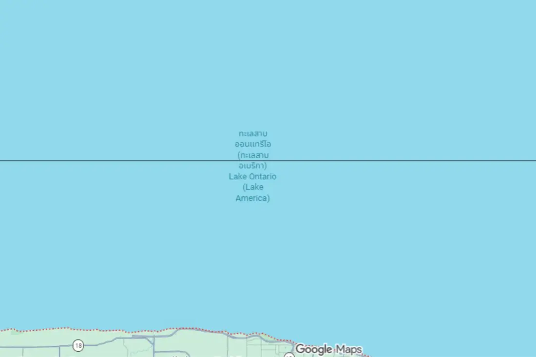
Open Google Maps in Toronto and you'll see Lake Ontario, same as always. Cross the border into New York state and the same body of water now reads "Lake America". The split display is the result of an executive order signed by President Donald Trump on 27 August 2026, directing US federal agencies to adopt the new name for the smallest of the five Great Lakes.
Google updated its platform to match the US government's Geographic Names Information System database, which is why the change appears on the map app. But it's not a global rename. Canadian authorities continue to recognise only the historical name, Lake Ontario, and the label carries no legal weight outside the United States.
To handle the disagreement, Google has rolled out geo-targeted labels: US users see "Lake America", Canadian users see "Lake Ontario", and everyone else gets the combined "Lake America (Lake Ontario)". It's the same playbook Google used after the 2025 order that turned the Gulf of Mexico into the "Gulf of America" for US federal usage.
The administration justified the move by pointing to the lake's role in the domestic economy, maritime shipping and its strategic position in the Great Lakes region. The order instructed the Department of the Interior and the Board on Geographic Names to update federal maps, databases and official documents.
For travellers, the practical takeaway is simple: the lake itself hasn't moved or changed. It still straddles the border between New York and the Canadian province of Ontario, and everything that makes it worth visiting — Toronto's waterfront, the Thousand Islands, Niagara's outlet into Lake Erie nearby — is untouched. What has changed is paperwork and pixels, and which name you see depends entirely on where your device says you are. If you're booking a Great Lakes road trip, don't be surprised when maps, signage and even official documents differ on either side of the border — and expect the same dual-labelling quirk to pop up in other apps as companies sync with government databases.