Southern Utah has no shortage of famous red rock, but Coyote Gulch might be its best-kept backpacking secret. Tucked into Grand Staircase-Escalante National Monument and spilling into Glen Canyon National Recreation Area, this desert canyon packs slot canyons, waterfalls and enormous natural arches into a hike of anywhere from 14 to 26 miles round trip — no permit lottery required.
That's the big practical draw. While a Grand Canyon backpacking trip means navigating a competitive permit system, Coyote Gulch permits are self-issued at the trailhead. Its lower elevation — about 4,500 feet versus the South Rim's 7,000 — also keeps it below the snow line, stretching the hiking season. And the effort-to-reward ratio is friendlier: the full route to the Escalante River involves around 2,500 feet of elevation change, roughly half of a Grand Canyon rim-to-rim crossing.
Start at the Hurricane Wash Trailhead, reached via 33 miles of dirt Hole-in-the-Rock Road off Highway 12 — passable by ordinary two-wheel-drive cars when dry. The first 3.5 miles are a sandy wash; after that you follow the creek itself, wading through shallow water the rest of the way. A lightweight water filter or LifeStraw lets you drink straight from the stream and keep your pack light.
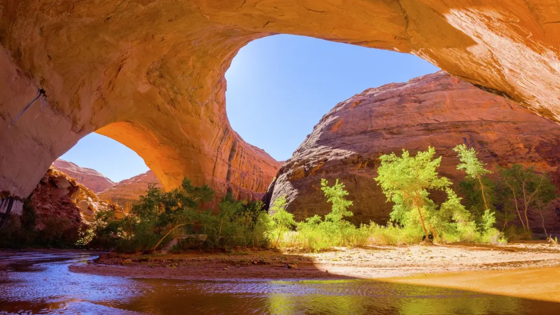
The scenery comes thick and fast. At around mile seven sits Jacob Hamblin Arch, a cathedral-like red rock amphitheatre that's among the most photographed spots in the state — and a realistic goal for a one-night weekend trip. Roughly a mile further is Coyote Natural Bridge, an archway spanning the creek, followed by a steep sandy slope leading up to a set of pictographs. Push on to the confluence with the Escalante River and a short walk upstream reveals Stevens Arch, one of the largest natural spans in the world. With an extra day, the Black Lagoon box canyon makes a worthy side trip.
Timing matters. Summers here are scorching and winters freeze hard, so aim for spring or fall — mid-November hikers report perfect conditions, bright foliage and near-empty trails. One caution: never trust a standard weather app for flash flood risk during monsoon season. Stop at the Interagency Visitor Center in the trail town of Escalante first for ranger advice, road conditions and the latest forecast, and download offline maps — there's zero cell service in the canyon.
For a two-night itinerary, base camp near Jacob Hamblin Arch, day-hike downstream to the river confluence with your gear left standing, then walk out on day three. Expect multiple creek crossings and bring footwear that can handle sustained wading — anyone who has hiked Zion's Narrows will know the drill. Guided options exist locally through outfitters like Dreamland Tours if you'd rather not go solo.
Who's this for? Anyone who has drooled over Grand Canyon photos but balked at the permit lottery, the crowds or the brutal elevation. Coyote Gulch delivers a similar scale of desert drama — arches, amphitheatres, waterfalls — with more solitude and simpler logistics. It demands self-sufficiency, but that's part of the appeal.