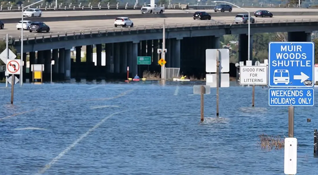
A stretch of the popular bike route between Mill Valley and Sausalito turned into an impromptu paddle trail this week, as unusually high tides pushed floodwater over roads and paths in Marin County, just north of San Francisco.
Drone footage published on October 27 shows kayakers gliding along the flooded path, while paddleboarders were spotted weaving between stranded cars in Mill Valley the day before. Not everyone took the surreal scene in stride: parts of Shoreline Highway near Highway 101 were closed, one driver had to be rescued from his car when water reached halfway up the doors on Miller Avenue, and a cyclist riding from Tiburon to Sausalito found her route home cut off. According to the San Francisco Chronicle, one section of Shoreline Highway went from dry to roughly two feet of water in about half an hour on October 27.
The culprit is a combination of king tides and a potentially historic Super El Niño. Warm water in the tropical Pacific has expanded northward, raising sea levels along the California coast and giving already-high tides an extra push. National Weather Service meteorologist Brian Garcia told Outside that water levels exceeded what's normally seen during the biggest winter tides — in October, a month when tidal flooding is rare.
The disruption isn't over yet. A coastal flood advisory runs through October 31, with more high tides expected to swamp low-lying roads and shoreline areas along the Marin bayshore.
The bigger picture is worth noting for anyone planning a Bay Area winter trip. Scientists have warned that this El Niño could temporarily lift ocean levels and supercharge storms, and some of the year's highest tides land around Thanksgiving, Christmas, and late January. If big storms coincide with those tides, California could see record coastal water levels. In other words, this week's kayaking commuters may be an early preview of the winter ahead.
For travellers, the takeaway is simple: if you're heading to Marin or the San Francisco waterfront between now and late January, check tide charts and road conditions before setting out on coastal paths, and have a plan B when king tides and storms line up. Cyclists who count on the Mill Valley–Sausalito route should be especially aware that it can vanish under water on the highest tides — though, as this week proved, it makes a decent kayaking backup.