Somewhere near the California–Oregon border, around mile 1,700 of the Pacific Crest Trail, a hiker who has spent nearly three months walking the length of California finally sees the sign that says it's over — deserts, Sierra passes, heat, injuries and all. A recent trail diary from The Trek captures what those last days before Oregon actually look like, and it's a revealing window into one of the toughest stretches of a thru-hike.
The final California miles start at Seiad Valley, where the trail climbs hard through burnt, blowdown-strewn forest. The writer opts for a gentler forest road for part of the ascent, then battles a punishing afternoon of steep, sun-exposed climbing with a knee that sends sharp pain through every awkward step. The day still clocks in around 25 miles with roughly 1,800 metres of elevation. A cold Dr Pepper from the general store does wonders for morale — trail life is measured in small pleasures.
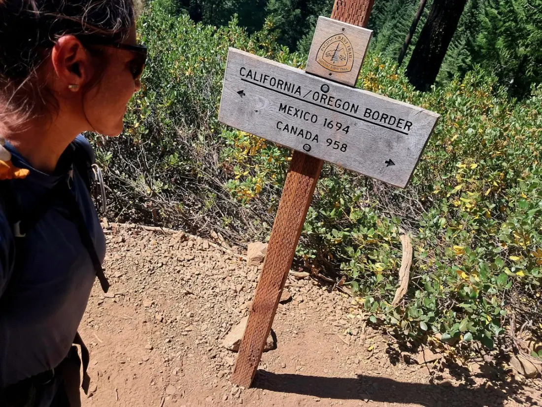
The payoff comes late morning: two signs and a logbook marking the state line. Nearly 1,700 miles from Mexico, with 950 left to Canada. The terrain shifts noticeably almost immediately — rocky forest gives way to open, yellow-grass hills — and, in a promising omen, there's trail magic (cold sodas in a cooler) waiting at the top of the first Oregon climb. That night the hiker beds down at Grouse Gap Shelter, where strangers gather to watch a meteor shower from the grass.
But the body has opinions. Feverish, exhausted and limping badly, the hiker faces a classic thru-hiker dilemma: grind out the last 10 miles to the highway, or accept a lift from a stranger heading to Ashland. Sanity prevails, and the stranger — who happens to speak French — delivers both a ride and a massage therapist's phone number. The diary's portrait of Ashland is affectionate: Lithia Park, creekside paths, cafés, wine bars, and a hostel mixing hikers with visitors in town for the town's famous Shakespeare Festival. The verdict from the massage: a few days off the trail and back on track.
For travellers, this stretch is worth knowing about even if you never attempt a thru-hike. The Seiad Valley–Ashland corridor offers shorter options — day hikes, the historic Donomore Cabin area, and views of Mount Shasta that steal the show throughout the story. Ashland itself emerges as a genuinely appealing base: a walkable small town with good food, a renowned festival, and easy access to the southern Oregon Cascades.
It's also a candid reminder of what long-distance hiking really costs. The romantic bits are real — trail angels, meteor showers, spontaneous kindness — but so are aching knees, dry camps with no morning coffee, and the discipline of knowing when to stop. Anyone dreaming of the PCT should read accounts like this alongside the highlight reels. And anyone just looking for a great Pacific Northwest getaway could do a lot worse than Ashland, with Mount Shasta looming to the south and the PCT threading through the hills behind town.