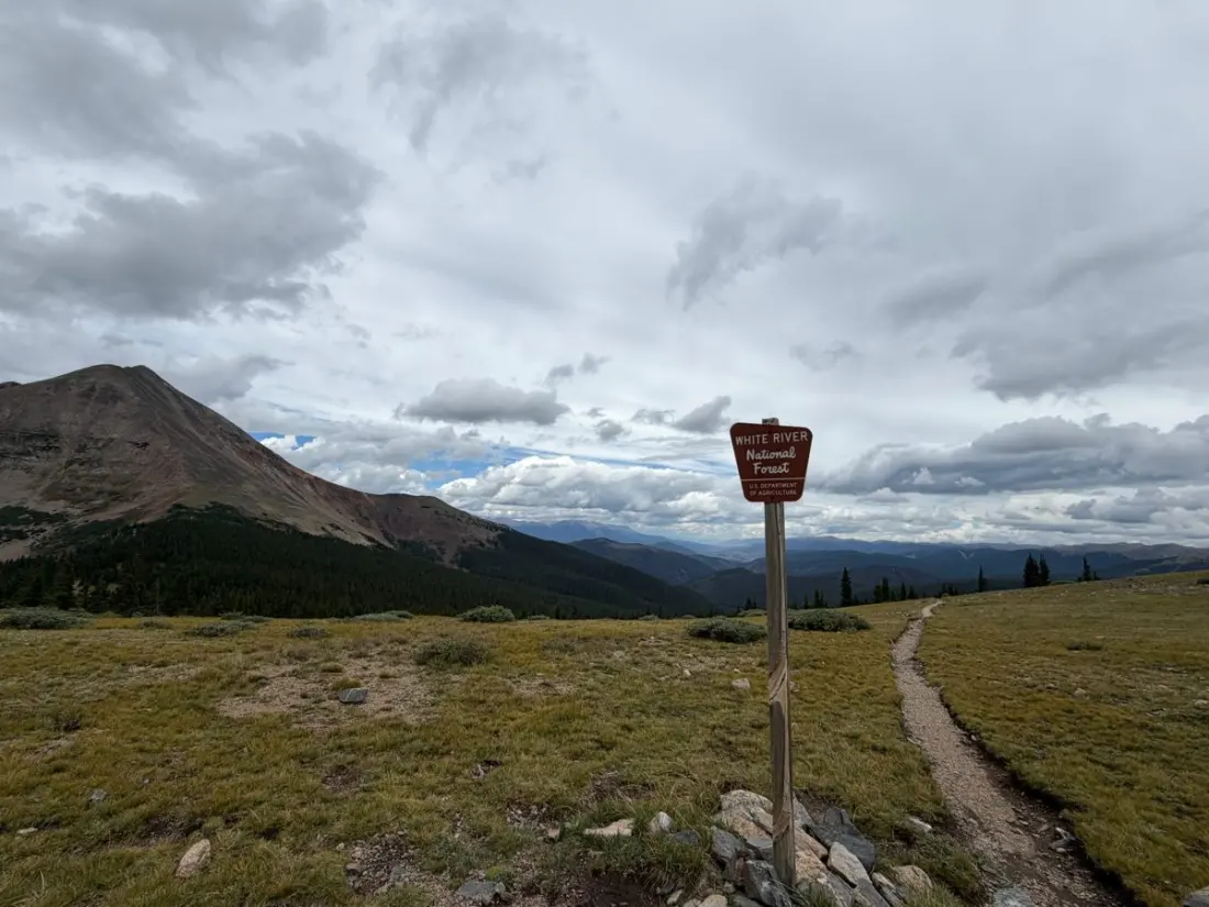
Somewhere near Breckenridge, Colorado, a long-distance hiker just crossed a milestone most of us will never reach on foot: Georgia Pass, at 11,800 feet, reached on day 12 of a thru-hike of the Colorado Trail. The day's leg covered 12.8 miles between Jefferson Creek and the Swan River, and it packed in just about everything the high Rockies can throw at a traveller — a 2,000-foot climb, afternoon thunderstorms, and a rare wildlife sighting.
The climb itself was the headline act: 5.3 miles of steady gain through cool pine forest, then a slow grind across alpine tundra once the trail pushed past 11,000 feet. That's the zone where the air thins out — the hiker reported managing only about 40 steps at a time before stopping to breathe, and struggling with altitude-related nausea at mealtimes. Georgia Pass also marks where the Colorado Trail joins the Continental Divide Trail, so hikers here are literally walking two iconic routes at once.
Here's the part most day-trippers get wrong: the descent was harder than the climb. Rocky, root-strewn trail led to a fall half a mile below the summit, and the next four and a half miles became an exercise in staring at the ground. Add a thunderstorm rolling in around 3 p.m. — close enough to force a 15-minute shelter break off trail — and you get a realistic picture of afternoon weather in Colorado's high country: clear mornings, storms arriving like clockwork after lunch.
The day wasn't all slog. A pine marten (recently reclassified as a Pacific marten) peeked out from a tree during the descent, and a deer darted across the trail ahead. Pika and marmots, staples of Colorado's alpine zones, stayed heard-but-unseen.
For anyone planning their own taste of the Colorado Trail, this stretch is a good one to borrow from. The section around Georgia Pass sits within easy reach of Frisco and Breckenridge — the hiker logged 13 miles to Frisco as the next day's goal — so you can sample the pass as a day hike or a short backpacking trip without committing to a 500-mile thru-hike. The takeaway from this account: start early, summit before the clouds build, and don't assume the way down is the easy half. Loose rock at altitude punishes tired legs. And if your appetite vanishes at 11,000 feet, that's normal — eat small and often.
This kind of first-person trail reporting is gold for trip planning. It tells you what guidebooks can't: how long the tundra actually slows you down, where storms tend to catch people out, and what you might spot if you keep your eyes up. Whether you're eyeing the full Colorado Trail or just a weekend above the trees near the Continental Divide, it's worth reading how the days actually unfold.
Original reporting via The Trek.