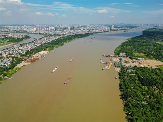
For decades Hà Nội has grown with its back turned to the river that gave it life. Dikes built to hold back floods also built a wall between the city and the Red River, leaving the banks underused, patchily serviced and disconnected from the streets nearby. Now that's set to change. The capital's new master plan — drawn up with a 100-year horizon — names the Red River as the city's central ecological, cultural and landscape axis, and planners are treating the shift as a defining move for 21st-century Hà Nội.
The scale is significant: roughly 11,000 hectares along both banks are earmarked as a combined zone for landscape, services, finance and culture. The flagship is the Red River Landscape Boulevard project, which city leaders describe as strategically vital, expected to restructure riverside space and spark new momentum in tourism, culture, services and innovation. Architect Trần Ngọc Chính, who chairs the Vietnam Urban Planning and Development Association, says the real difference from previous attempts is that the river is now treated as a strategic spine — one that could knit the two banks into a single urban whole as new bridges and roads arrive, and push the city's expansion northward.
Flood safety comes first. Experts insist development cannot mean paving over the floodplain. Planners describe a three-layer approach: the riverbed itself strictly protected, mid-river islets and alluvial flats left to absorb water and sustain ecosystems, and urban construction inside the dikes tightly controlled on density, height and design. Hydrology, dredging and drainage corridors all get reviewed before anything is built.
What makes this interesting for travellers is the heritage layer. The banks are described as a living museum of Thăng Long-Hà Nội — ancient villages, craft villages like the famous ceramics hub of Bát Tràng, old river wharves, festivals and religious sites accumulated over centuries. The plan explicitly avoids turning the waterfront into one uniform strip; instead, planners want river tourism routes and creative spaces that link these sites while keeping their character intact. Architects also want any new landmark buildings to sit lightly in the landscape rather than obscure the heritage or cut communities off from the water.
If it all comes off, the Red River could become one of Hà Nội's largest public spaces — parks, gardens, squares and riverside walks connecting both banks and the major development centres. For visitors, that means a trip to Hà Nội in the coming years will increasingly involve the river itself: boat routes through craft villages, green corridors for a break from the Old Quarter's intensity, and a waterfront that finally works as a destination rather than a barrier. The river that shaped the old imperial capital is being positioned as the city's new front door.