Iceland is bracing for a genuinely unusual bit of weather. Forecasters are tracking a low-pressure system expected to sweep toward the island on Wednesday, and the latest model runs suggest it could deepen to something rarely — if ever — seen in Icelandic records.
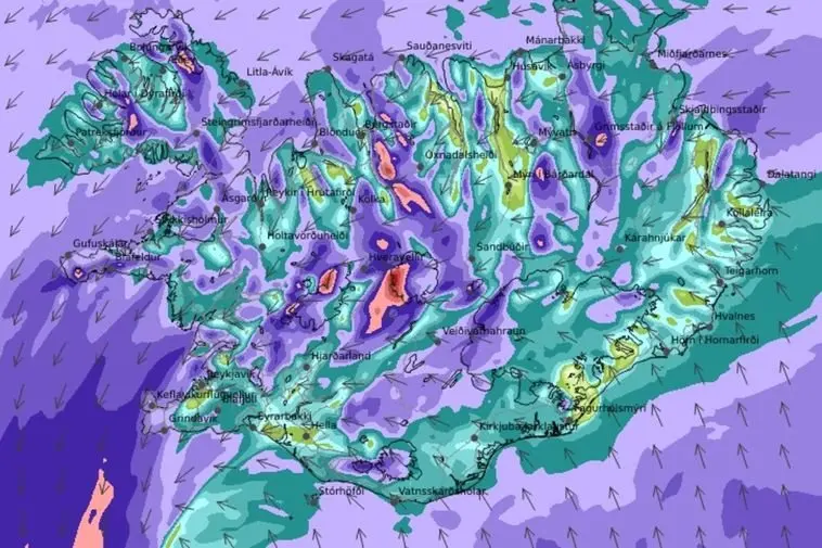
The Icelandic Meteorological Office is forecasting severe northerly winds and heavy precipitation as the system approaches, with snow expected across northern Iceland through Wednesday afternoon and evening. Meteorologist Einar Sveinbjörnsson, of weather service Blika, flagged the storm in a public post and urged that it be watched carefully over the coming days.
What has caught forecasters' attention is the projected depth of the system. By Wednesday afternoon, pressure readings of around 936 hPa are expected just off Hornafjörður in the country's southeast. For context, pressure that low is essentially unheard of near Iceland: the only recorded measurement below 940 hPa in the country dates back to 1963, when Stórhöfði in the Westman Islands logged 938 hPa. Conditions during that historic event were reportedly dire, with coastal flooding adding to the misery.
Sveinbjörnsson's warning is blunt: storms of this intensity near Iceland almost always cause disruption, and sometimes serious problems and property damage. He also points out that the forecast has shifted — the system is now expected to deepen further than earlier runs suggested — which is exactly why the next two to three days will matter. One reassuring note for perspective: even a 936 hPa reading pales next to the monsters seen in the tropical Atlantic, as his quip comparing Atlanta to Akureyri makes clear.
If you're in Iceland this week, or planning to be, treat Wednesday as a day to stay flexible. Expect possible road closures, ferry and flight disruption, and rough coastal conditions, especially in the north where snow is forecast and along exposed southern and eastern shores. Keep an eye on vedur.is, Iceland's official weather service, and local civil defence alerts — conditions can escalate quickly when systems deepen offshore.
For travellers, this is a good reminder that Iceland's weather operates on its own terms, particularly outside summer. Road trips along the south coast or Ring Road in the shoulder seasons should always build in weather buffer days, and a hire car in a severe storm is best left parked. The flip side: once the low passes, skies often clear dramatically, and there are worse sights than fresh snow on the northern fjords under a post-storm sun.
Story originally reported by Iceland Monitor.