
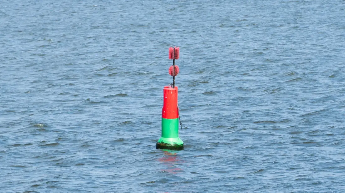
Spotting a red and green striped buoy on the water can confuse even experienced holiday boaters. Unlike the familiar all-red or all-green channel markers, these two-tone buoys aren't marking the edge of a channel at all. They're telling you something more useful: the channel ahead splits in two.
Known as bifurcation, junction, or preferred-channel buoys, their message comes down to one simple detail — which colour is on top. The upper band signals the main or preferred route. If green sits on top, the preferred channel veers toward the green side; if red is on top, follow the red.
How you physically pass the buoy, though, depends entirely on where in the world you're boating. The International Organization for Marine Aids to Navigation (IALA) divides the globe into two systems. Region B covers North and South America, Japan, South Korea, and the Philippines. There, the rule of thumb is "red right returning": keep red buoys to starboard (your right) and green buoys to port (your left) when heading back to port or upstream. A green-topped preferred-channel buoy should be left to port; a red-topped one to starboard. So whether you're cruising the Great Lakes or chartering in the Bahamas, the same rule applies.
Region A — which takes in Europe, Africa, Asia, and Australia — flips everything. On a yacht charter in Croatia or Greece, a red-topped buoy goes to your left and a green-topped one to your right, the mirror image of the American system. The colours and shapes are identical worldwide; only the side you pass them on changes.
Why does this matter for travellers? Renting a small boat, joining a sailing holiday, or skippering a charter in a foreign country is one of the great holiday pleasures, and it's exactly when this knowledge gets tested. An American used to Region B rules who rents a dinghy in the Mediterranean could quietly steer into the lesser channel — or worse, shallow water — by instinctively passing markers the wrong way. A ten-second check of the top band, plus a mental note of which system you're in, keeps you on the main route.
It's also handy beyond the helm. Snorkellers, kayakers, and paddleboarders who can read basic navigation marks get a better sense of where the deep, safe water runs — and where motor traffic is likely to be. Striped buoys, in particular, point you toward the busiest, best-marked stretches of a coastline.
The takeaway is simple: colour and shape are the water's language, and they're largely universal. Just remember to look at the top band, know whether your destination is Region A or Region B, and pass the buoy accordingly. Do that, and the one piece of water signage most holidaymakers find baffling becomes the easiest to read.