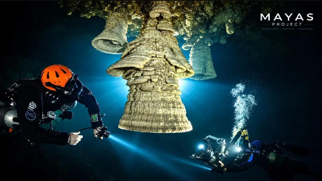
Beneath the beaches of the Riviera Maya lies a water system so vast that scientists admit they've only ever seen its edges. Around 2,000 kilometres of flooded cave passages have already been explored and mapped across the Yucatán Peninsula — including Ox Bel Ha and Sac Actun, the two longest known underground river systems on Earth. Now a new research effort called the MAYAS Project is betting that even those record-holders are just side branches of something far bigger.
The project, backed by Mexico's National Commission of Natural Protected Areas (Conanp) and funded in part by the Rolex Perpetual Planet Initiative, is led by cave diving explorer Robbie Schmittner with an international team. Its central hypothesis is bold: the famous flooded caves are secondary features of a much larger hydraulic system whose main conduits remain essentially unexplored. Even more striking, researchers think powerful ocean currents squeezing through the Yucatán Channel — between the Caribbean Sea and the Gulf of Mexico — may be the main engine driving groundwater movement hundreds of metres below the jungle floor.
The work happens on three levels at once. Drones fitted with geophysical instruments scan from the air, hunting for hidden fracture zones and possible cave structures. Surface teams chase those clues, locating cenotes and other natural doorways into the aquifer. And below, specialised cave divers map flooded passages, measure flow rates and water quality, and collect samples for DNA, algae and bacteria analysis. Six major geological structures anchor the research: the Ring of Cenotes, Sierrita de Ticul, Río Hondo, Holbox, Akumal and the Arco de La Libertad.
Why should a traveller care? Because this aquifer is the region's lifeblood. The drinking water in your hotel, the health of the reefs you snorkel, and the cenotes you swim in all depend on it. Pollutants dumped anywhere in the system can travel enormous distances underground, surfacing in ecosystems far from their source — and near-shore springs can carry that water straight onto the reefs. Understanding the plumbing helps authorities decide which areas need protection, which matters for anyone hoping the Riviera Maya's cenotes and coral stay swimmable for years to come.
The findings won't stay in academic journals either. Conanp says results will feed into conservation planning and public education programmes for schools, universities and the general public — meaning travellers may soon hear far more about what's flowing beneath their feet.
For now, the project covers the Yucatán Peninsula and stretches into Veracruz and southern Mexico, with Belize and Guatemala on the roadmap. If the team is right, the world's largest known underwater cave systems could turn out to be the tip of a much larger iceberg.
While the science unfolds, visitors can experience the existing mapped wonders for themselves: dive or snorkel the Sac Actun and Ox Bel Ha systems near Tulum, or explore the cenote ring that circles the old Chicxulub impact crater.