Most visitors to El Salvador stick to a short list: the surf breaks, Ruta de las Flores, a volcano or two. But this compact country — you can drive coast to coast in a few hours — hides a much longer list of quiet corners, and El Salvador Info has pulled together ten of the best lesser-known spots.
In the eastern hills of Morazán, Río Sapo cuts through forested countryside, leaving turquoise-green pools that locals swim in and photographers love. The same department holds the Gruta del Espíritu Santo near Corinto, a vast rock shelter painted with prehistoric figures and symbols whose age and meaning archaeologists are still working out. Nearby, Cinquera Forest doubles as nature reserve and history lesson: guerrilla fighters used these hills during the civil war, and today's trails pass natural pools, viewpoints and conflict-era sites, best explored with a local guide.
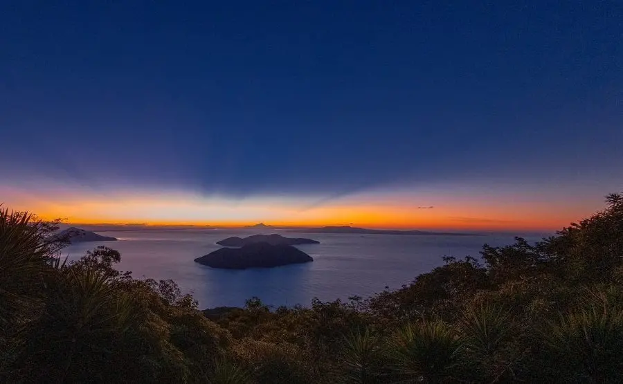
Volcano country offers its own surprises. Laguna de Alegría sits inside the crater of Tecapa Volcano above the laid-back mountain town of Alegría in Usulután, its mineral-rich water shifting through shades of green. In the far west, Montecristo National Park's cloud forest — where El Salvador, Guatemala and Honduras meet — brings mist, mossy trees and rare birds, though some trails need advance permission. El Imposible National Park in Ahuachapán protects steep, rugged tropical forest that rewards prepared hikers, ideally with an authorised guide. And for a payoff view, Conchagua Volcano in the southeast serves up sunrise panoramas over the Gulf of Fonseca; some travellers camp overnight near the viewpoints.
The coast has quieter options too. Jiquilisco Bay, also in Usulután, holds some of the country's most important mangrove forest — guided boat trips thread the narrow channels past herons and egrets, and the bay is a key nesting area for the critically endangered hawksbill turtle. Further east, Meanguera Island in the Gulf of Fonseca runs on fishing-village time; getting there means a boat whose schedule and the sea conditions you should check carefully. Close to colonial Suchitoto in Cuscatlán, Los Tercios waterfall is less about water and more about geology: a cliff of tightly packed hexagonal volcanic columns that looks like stacked blocks, dramatic when rain swells the flow.
Practical planning matters more out here. Rural roads, phone signal and services can be patchy, several protected areas limit visitor numbers or require permits, and seasons change everything — heavy rain makes trails slippery and rivers risky, while the dry season shrinks waterfalls and pools. Check current conditions with local guides, tour operators or the Ministry of Tourism before committing, and don't try to cram all ten into one trip. Picking two or three, slowing down and hiring local guides gets you far more out of each one.
For travellers tired of a trail that everyone else has already posted, these spots deliver: swimming holes without crowds, rock art in the open air, a crater lake, mangroves and island life — all within a country small enough to explore properly in a week or two.