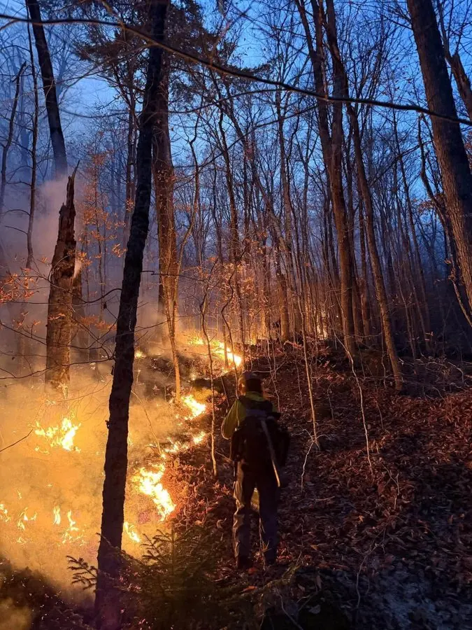
A rare, large wildfire is burning in the White Mountain National Forest in northern New Hampshire, and anyone planning a late-season hike in the region should know the details before heading out. The Wild River Fire, first reported on 1 November in steep country south of Gorham, has burned roughly 856 acres and was 11% contained at the latest update. Drought conditions helped it spread fast through rugged terrain, and while no homes are threatened, the blaze is remarkable by local standards: Gorham's fire chief told New Hampshire Public Radio the biggest wildfire anyone there could recall was under 100 acres, more than two decades ago.
The US Forest Service says the fire is likely the result of human activity, though the investigation is ongoing. Firefighters are contending with dry ground and difficult access, but officials report steady progress on containment.
For hikers, the key practical point is the closure order now in place around the fire area. The Appalachian Trail itself passes northwest of the fire and remains open, but the Appalachian Trail Conservancy has asked walkers to be careful, obey fire crews and posted signs, and expect smoke in the air. The Kenduskeag Trail — which meets the AT near northbound mile 1,894.8 — is closed entirely.
Even if you're not a thru-hiker, this matters for anyone with autumn or early-winter plans in the Whites. The Wild River area is a quiet corner of the forest popular with backpackers who want to dodge the crowds on Franconia Ridge or Mount Washington, and closures there can shuffle itineraries quickly. Conditions are also a reminder that drought-driven fire risk is no longer confined to the American West; New England has seen unusually dry spells in recent years, and campfire discipline matters even in famously green states.
If you have a trip booked nearby, check the White Mountain National Forest Facebook page or the Watch Duty wildfire app before you go — fire lines and closure boundaries are moving as mapping improves and crews make headway. The acreage estimate actually dropped from nearly 1,000 to 856 after updated mapping, which shows how fluid the numbers are.
For travellers, the takeaway is simple: the trail network around Gorham is largely still accessible, but respect closures, carry a map with the fire perimeter marked, and be prepared to change plans if the closure zone expands. This story was reported by The Trek.