The disaster that tore through Nepal's Rasuwa district has been widely dubbed a 'Himalayan tsunami'. Writing in Nepali Times, climate strategist Arup Rajouria argues that the label is not just inaccurate — it could shape how Nepal prepares for the next one, for the worse.
A tsunami, by definition, needs a large body of water displaced suddenly, usually by an undersea earthquake or landslide. Rasuwa had neither. What actually happened, according to the evidence cited, was a massive slope failure on the north face of Langtang Lirung: bedrock and glacier ice broke away, fell roughly 1,200 metres into the Lhende Khola valley, and shattered into a fast-moving mix of rock, ice and meltwater. One estimate puts the leading edge of the debris flow at around 190 km/h over its first 22 kilometres, though scientists caution the figures are still being verified.
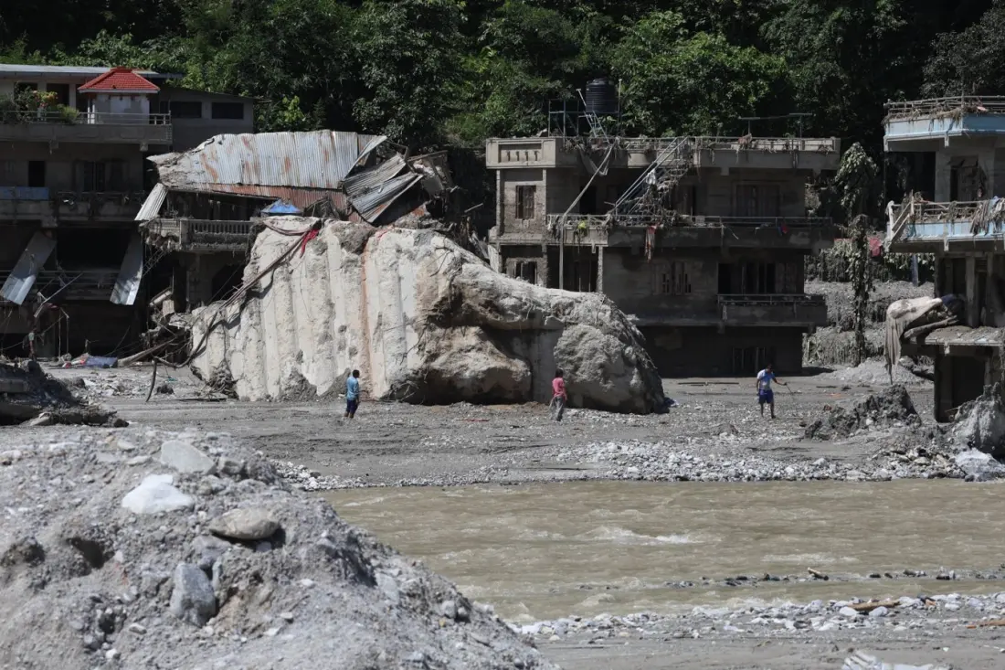
The avalanche then blocked the river. Water and debris piled up behind the unstable dam until it gave way, sending a violent surge of mud, rock and water down the Bhote Kosi and Trisuli river systems. It was a cascading chain — slope collapse, ice-rock avalanche, river blockage, dam breach, flood — not a giant wave. It was not a glacial lake outburst either, and not a routine monsoon flood. The distinction matters because a tsunami framing points all the attention downstream, to river gauges, sirens and evacuation routes. The real danger started high up, on an unstable slope that nobody was watching.
Rajouria's wider point is that Nepal's disaster planning has focused heavily on glacial lakes, but a warming Himalaya creates other threats: retreating glaciers undercut valley walls, thawing permafrost loosens fractured rock, and meltwater and heavy rain add pressure to slopes already near their limits. The Hindu Kush Himalaya holds the largest ice reserves outside the poles — some 54,000 glaciers across about 60,000 sq km — feeding ten-plus major Asian rivers that over two billion people rely on, with around 240 million people living in the mountains themselves.
The article calls for an International Center for Glaciers and Permafrost: a working scientific body that would monitor dangerous slopes, map where avalanches could dam rivers, share data across borders, and help governments protect roads, hydropower and settlements in narrow valleys — before disasters happen rather than after.
For travellers, the relevance is direct. The Langtang region is a popular trekking area, and Rasuwa sits on the overland route toward the Tibetan border. Mountain hazards here are evolving in ways that don't follow the familiar monsoon-flood script, so anyone heading into Nepal's high valleys should follow local advisories closely, expect possible disruption to roads and trails in river corridors, and take official warnings about slopes and rivers seriously. The recovery is ongoing — people are still missing along the river — so sensitive, well-informed travel matters too. Source: Nepali Times.