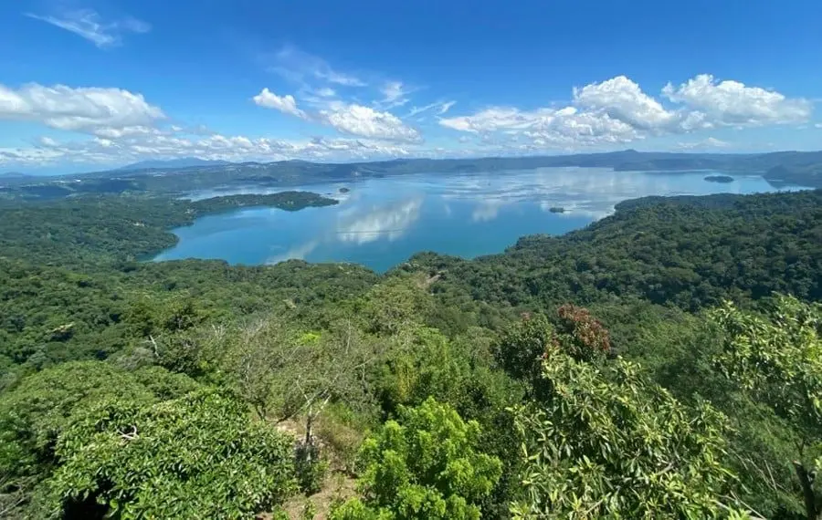
Under an hour from San Salvador, a winding mountain road loops above a vast volcanic lake, threading through half a dozen small towns where roadside terraces serve pupusas with a view. This is the Ruta Panorámica de Ilopango — one of El Salvador's quieter tourist routes, and a genuine alternative to the beaches and volcano hikes most visitors stick to.
The route runs southeast of the capital through Santiago Texacuangos, San Francisco Chinameca, San Juan Tepezontes, San Miguel Tepezontes, San Emigdio and Paraíso de Osorio, crossing the departments of San Salvador, La Paz and Cuscatlán. There's no single headline attraction — the draw is the drive itself, with the caldera lake below, green hills all around, and rural communities where everyday Salvadoran life plays out at an unhurried pace.
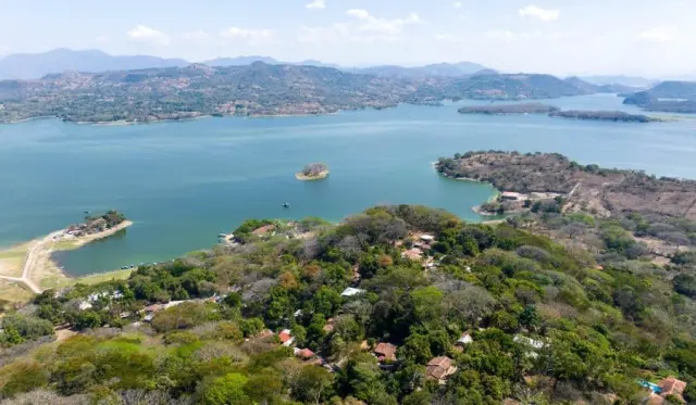
Lake Ilopango is the star. The lake fills a volcanic caldera, and the elevated stretches of road deliver sweeping views across its broad waters. Clear mornings give the best visibility for photos; cloudy days bring mist and moody light that transform the landscape entirely. Several viewpoints are tied to restaurants or private establishments, so plan your stops at places with proper parking and safe access rather than pulling over on tight curves.
Food is half the reason to come. Restaurants along the route serve traditional dishes — pupusas, grilled meats, soups and hearty breakfasts — often from terraces overlooking the lake. Menus vary from place to place, and opening hours aren't always reliable, so it's worth checking a spot before you build your day around it.
The higher towns of San Juan and San Miguel Tepezontes are favourites with photographers and anyone seeking quiet mountain air, while San Emigdio and Paraíso de Osorio further east offer farmland, hilly terrain and small-town streets largely free of tourists. Strolling town squares, browsing local shops or popping into a church adds texture to the trip — and spending money at family-run eateries and markets is the best way to support these communities.
Practically speaking, a car is by far the easiest way to do the route. From the capital, head through Santiago Texacuangos towards San Francisco Chinameca and follow the corridor at your own pace. Public transport exists but usually requires transfers, and some spots are awkward to reach without wheels. Roads include curves, hills and narrow sections, so drive cautiously in rain or fog. Hikers should note that some trails cross private land and lack signage — ask locally before setting out.
Timing matters more than season. El Salvador's dry season (November to April) delivers clear skies and reliable views, while the May-to-October rains turn the hillsides lush but can obscure the lake behind afternoon showers. Start in the morning for the best sightseeing conditions, and leave enough daylight for mountain driving on unfamiliar roads.
If you want to extend the trip, the lake itself offers waterfront restaurants and water activities run by local operators, and the city of Cojutepeque nearby is famous for its sausages and food culture. Whether you carve out a lazy afternoon or a full day, the Ruta Panorámica rewards travellers who'd rather slow down than tick boxes — and shows a side of El Salvador the beach crowds never see.